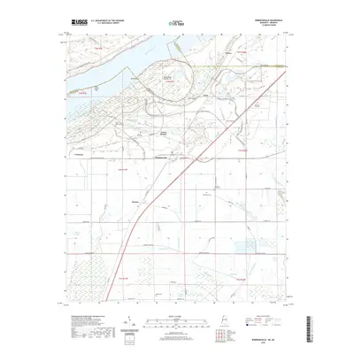
2020 Map of Robinsonville
USGS Topo · Published 2020About this map
The Mississippi River forms a wide arc at the top of this sheet, defining the state boundary between Arkansas and Mississippi. The alluvial plain is dominated by agricultural drainage patterns and the heavy infrastructure of modern hospitality near Tunica Resorts. Historically significant settlements like Commerce and Robinsonville sit atop the levee system, while the interior is marked by a network of bayous including Fish Lake Bayou and Lost Lake Bayou. The landscape's social history is recorded in several small, family and community burial grounds, such as Morning Star Cem and Bethlehem Cem, which are tucked away near local thoroughfares like Buck Island Rd. A series of levees, including the Mississippi River Levee, protects the low-lying farmland and developed corridors of Bowdre from the volatile river. The layout of Old Hwy 61 and various resort parkways reflects the transformation of this delta region into a commercial destination.
Find a feature on this map
72 named features on this map. Tap any name to fly to it.
Don’t see what you’re looking for? This feature index may not catch every label — zoom into the map to look around manually.
Map Details
Editions of this 2020 Robinsonville Map
This is the sole edition of this map. No revisions or reprints were ever made.
Other maps of this area

1908 · Hollywood
USGS Topo · 1:24,000

1908 · Lake Cormorant
USGS Topo · 1:24,000

1912 · Lake Cormorant
USGS Topo · 1:31,680

1913 · Hollywood
USGS Topo · 1:31,680

1931 · Horseshoe Lake
USGS Topo · 1:62,500

1932 · Horn Lake
USGS Topo · 1:48,000

1932 · Crenshaw
USGS Topo · 1:62,500

1935 · Crenshaw
USGS Topo · 1:62,500

1935 · Horn Lake
USGS Topo · 1:62,500

1939 · Clayton
USGS Topo · 1:62,500