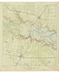
1925 Map of Robstown
USGS Topo · Published 1925About this map
Nueces River serves as the dividing line between San Patricio and Nueces counties, winding through a landscape of marshes and islands before opening into Nueces Bay. During the mid-1920s, this region was a critical junction of rail transportation and early industrial infrastructure, centered on the growing hub of Robstown. The map documents a dense network of lines, including the St Louis Brownsville and Mexico and the San Antonio Uvalde and Gulf, which facilitated the transport of agricultural goods from outlying sidings like Bullard Siding. Public life is anchored by local institutions such as Riverside School and Tulosa School, while the Corpus Christi Pumping Sta at Calallen highlights the importance of the river for regional water management. Smaller settlements like Nuecestown and Violét appear along the rail corridors, illustrating the settlement patterns of Coastal Bend Texas before the expansion of modern highways.
Find a feature on this map
32 named features on this map. Tap any name to fly to it.
Don’t see what you’re looking for? This feature index may not catch every label — zoom into the map to look around manually.
Map Details
Editions of this 1925 Robstown Map
Other maps of this area

1924 · Petronilla
USGS Topo · 1:62,500

1925 · Robstown
USGS Topo · 1:62,500

1925 · Oso Creek
USGS Topo · 1:62,500

1925 · Corpus Christi
USGS Topo · 1:62,500

1927 · Mathis
USGS Topo · 1:62,500

1950 · Corpus Christi
USGS Topo · 1:250,000

1951 · Corpus Christi
USGS Topo · 1:24,000

1951 · Corpus Christi
USGS Topo · 1:62,500

1951 · Oso Creek NW
USGS Topo · 1:24,000

1951 · Oso Creek
USGS Topo · 1:62,500