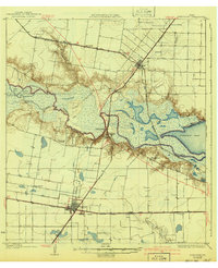
1925 Map of Robstown
USGS Topo · Published 1941About this map
The Nueces River serves as the winding dividing line between San Patricio and Nueces counties, defining a landscape of low-lying marshlands and coastal prairies in the mid-1920s. The convergence of three major rail lines—the St Louis Brownsville and Mexico, the Texas Mexican, and the San Antonio and Aransas Pass—dictates the settlement patterns of the era. Robstown emerges as a significant rail junction in the south, while Odem anchors the northern territory.
Find a feature on this map
29 named features on this map. Tap any name to fly to it.
Don’t see what you’re looking for? This feature index may not catch every label — zoom into the map to look around manually.
Map Details
Editions of this 1925 Robstown Map
Other maps of this area

1924 · Petronilla
USGS Topo · 1:62,500

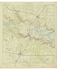
1925 · Robstown
USGS Topo · 1:62,500

1925 · Oso Creek
USGS Topo · 1:62,500

1925 · Corpus Christi
USGS Topo · 1:62,500

1927 · Mathis
USGS Topo · 1:62,500

1950 · Corpus Christi
USGS Topo · 1:250,000

1951 · Corpus Christi
USGS Topo · 1:24,000

1951 · Corpus Christi
USGS Topo · 1:62,500

1951 · Oso Creek NW
USGS Topo · 1:24,000

1951 · Oso Creek
USGS Topo · 1:62,500