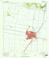
1969 Map of Robstown
USGS Topo · Published 1977About this map
The agricultural and industrial character of coastal Texas is evident in this survey of Robstown and the surrounding Nueces County landscape. The city center is a grid defined by major thoroughfares like Main Ave and Ashburn Ave, bounded by the busy Texas Mexican and Missouri Pacific railroad lines. Settlement patterns are varied, ranging from the concentrated residential blocks of San Pedro to more specialized sites like the Robstown Labor Camp and the outlier community at Five Points.
Find a feature on this map
35 named features on this map. Tap any name to fly to it.
Don’t see what you’re looking for? This feature index may not catch every label — zoom into the map to look around manually.
Map Details
Editions of this 1969 Robstown Map
3 editions found
Other maps of this area

1924 · Petronilla
USGS Topo · 1:62,500

1925 · Robstown
USGS Topo · 1:62,500

1950 · Corpus Christi
USGS Topo · 1:250,000

1954 · Orange Grove
USGS Topo · 1:62,500

1954 · Robstown
USGS Topo · 1:62,500

1954 · Kingsville
USGS Topo · 1:62,500

1954 · Petronila
USGS Topo · 1:62,500

1956 · Corpus Christi
USGS Topo · 1:250,000

1960 · Corpus Christi
USGS Topo · 1:250,000

1966 · Corpus Christi
USGS Topo · 1:250,000