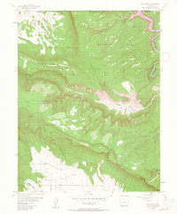
1960 Map of Roc Creek
USGS Topo · Published 1961About this map
Sinbad Valley and the Paradox Valley converge in this 1960 revision, illustrating a landscape defined by dramatic geological uplift and early mid-century mineral extraction. The map documents the mining activity prevalent in the canyon country, specifically naming the Radium Cycle Mine, the Rajah Mine, and the Sunrise Mine. These sites, connected by rugged routes like the Radium Trail and Jeep Trail, highlight the region's historical importance to the domestic uranium and vanadium industry.
Find a feature on this map
23 named features on this map. Tap any name to fly to it.
Don’t see what you’re looking for? This feature index may not catch every label — zoom into the map to look around manually.
Map Details
Editions of this 1960 Roc Creek Map
3 editions found
Other maps of this area

1885 · La Sal
USGS Topo · 1:250,000

1916 · Paradox Valley
USGS Topo · 1:125,000

1922 · Paradox Valley
USGS Topo · 1:125,000

1948 · Roc Creek
USGS Topo · 1:24,000

1948 · Paradox
USGS Topo · 1:24,000

1949 · Davis Mesa
USGS Topo · 1:24,000

1949 · Paradox
USGS Topo · 1:24,000

1949 · Roc Creek
USGS Topo · 1:24,000

1949 · Juanita Arch
USGS Topo · 1:24,000

1949 · Red Canyon
USGS Topo · 1:24,000