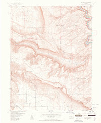
1960 Map of Roc Creek
USGS Topo · Published 1961About this map
Sinbad Valley and the surrounding high plateaus define this West Slope landscape, where uranium and radium mining shaped the local economy by 1960. The terrain is marked by dramatic geological formations, including Sewemup Mesa and the long expanse of Carpenter Ridge. Industrial activity is evident throughout the canyons, with the Radium Cycle Mine, Rajah Mine, and Redbird Mine highlighting the era's focus on mineral extraction. The Dolores River winds through the northeastern corner of the map, while Roc Creek cuts through the central mesas towards Carpenter Flats. Remnants of earlier ranching life persist at Pace Ranch in the northwest, situated near the boundary of the Manti-La Sal National Forest. Steep trails like the Radium Trail and deep cuts like Garvey Gulch reveal a network of access points used by miners and ranchers navigating this complex topography.
Find a feature on this map
21 named features on this map. Tap any name to fly to it.
Don’t see what you’re looking for? This feature index may not catch every label — zoom into the map to look around manually.
Map Details
Editions of this 1960 Roc Creek Map
3 editions found
Other maps of this area

1885 · La Sal
USGS Topo · 1:250,000

1916 · Paradox Valley
USGS Topo · 1:125,000

1922 · Paradox Valley
USGS Topo · 1:125,000

1948 · Roc Creek
USGS Topo · 1:24,000

1948 · Paradox
USGS Topo · 1:24,000

1949 · Davis Mesa
USGS Topo · 1:24,000

1949 · Paradox
USGS Topo · 1:24,000

1949 · Roc Creek
USGS Topo · 1:24,000

1949 · Juanita Arch
USGS Topo · 1:24,000

1949 · Red Canyon
USGS Topo · 1:24,000