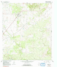
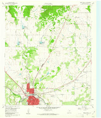
1963 Map of Rochelle
USGS Topo · Published 1991About this map
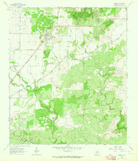
Rochelle stands as the central hub of this McCulloch County landscape in the early 1960s, situated at the junction of several local roads and the Gulf Colorado and Santa Fe Railway. The settlement's layout includes an Athletic Field and the nearby Rochelle Cem, serving the local agricultural community. To the southwest, the Soldiers Waterhole Historical Monument marks a specific point of local heritage near the banks of West Onion Cr.
Find a feature on this map
15 named features on this map. Tap any name to fly to it.
Don’t see what you’re looking for? This feature index may not catch every label — zoom into the map to look around manually.
Map Details
Editions of this 1963 Rochelle Map
2 editions found
Other maps of this area
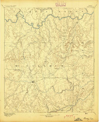
1894 · Brady
USGS Topo · 1:125,000

1928 · Mercury
USGS Topo · 1:62,500
1928 · Waldrip
USGS Topo · 1:62,500
1950 · Mercury
USGS Topo · 1:62,500

1954 · Brownwood
USGS Topo · 1:250,000
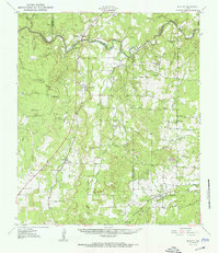
1960 · Brady North
USGS Topo · 1:24,000
1963 · Pecan Springs
USGS Topo · 1:24,000
1963 · Voca
USGS Topo · 1:24,000
1963 · Lost Creek
USGS Topo · 1:24,000
1963 · Rochelle
USGS Topo · 1:24,000