
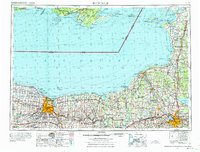
1961 Map of Rochester
USGS Topo · Published 1973About this map
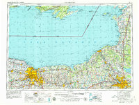
The vast expanse of Lake Ontario dominates this mid-century survey, illustrating the complex international maritime boundary between Canada and the United States. The coastal landscape is defined by its deep bays and prominent points, from the sprawling Henderson Bay and Mexico Bay in New York to the intricate shores of Prince Edward Bay in Ontario. Inland, the map reveals a post-war infrastructure booming with the heavy line of the New York State Thruway cutting across the southern tier and the extensive rail network of the New York Central connecting established industrial centers. The drainage patterns of the Genesee River, Seneca River, and Oneida River emphasize the region's historic reliance on water for transit and power. To the southeast, the protected marshes of the Montezuma National Wildlife Refuge stand in contrast to the growing residential and commercial grids of the larger settlements.
Find a feature on this map
186 named features on this map. Tap any name to fly to it.
Don’t see what you’re looking for? This feature index may not catch every label — zoom into the map to look around manually.
Map Details
Editions of this 1961 Rochester Map
3 editions found
Other maps of this area

1893 · Sackets Harbor
USGS Topo · 1:62,500

1895 · Chittenango
USGS Topo · 1:62,500

1895 · Sacketts Harbor
USGS Topo · 1:62,500

1895 · Rochester
USGS Topo · 1:62,500

1895 · Stony Island
USGS Topo · 1:62,500

1895 · Ontario Beach
USGS Topo · 1:62,500

1895 · Pulaski
USGS Topo · 1:62,500

1895 · Watertown
USGS Topo · 1:62,500

1895 · Cape Vincent
USGS Topo · 1:62,500

1895 · Syracuse
USGS Topo · 1:62,500