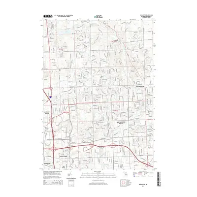
2014 Map of Rochester
USGS Topo · Published 2014About this map
Rochester and Rochester Hills anchor this detailed suburban landscape in the early 2010s, where education and industry intersect with historic cemetery grounds. The map reveals a dense network of residential streets and educational campuses, including Oakland Univ, Rochester Coll, and Baker Coll of Auburn Hills. Geologists and local historians can trace the course of the Clinton River as it passes through the southern portion of the quadrangle near Auburn Heights and Oak Grove. To the north, the terrain transitions into the protected open spaces of Bald Mtn, where the landscape is carved by Paint Creek and Trout Creek. Numerous burial sites such as Mt Avon Cem, Bigler Cem, and Christian Memorial Estates provide important genealogical markers across the developed landscape of Oakland County.
Find a feature on this map
391 named features on this map. Tap any name to fly to it.
Don’t see what you’re looking for? This feature index may not catch every label — zoom into the map to look around manually.
Map Details
Editions of this 2014 Rochester Map
This is the sole edition of this map. No revisions or reprints were ever made.
Other maps of this area

1907 · Pontiac
USGS Topo · 1:62,500

1908 · Rochester
USGS Topo · 1:62,500

1936 · Warren
USGS Topo · 1:31,680

1936 · Birmingham
USGS Topo · 1:31,680

1936 · Rochester
USGS Topo · 1:31,680

1936 · Washington
USGS Topo · 1:31,680

1936 · Pontiac South
USGS Topo · 1:31,680

1936 · Pontiac North
USGS Topo · 1:31,680

1943 · Pontiac South
USGS Topo · 1:24,000

1943 · Pontiac North
USGS Topo · 1:24,000
Featured Places
- Rochester Hills, MI
- Pontiac, MI
- Orion Charter Township, MI
- Auburn Hills, MI
- Oakland Charter Township, MI