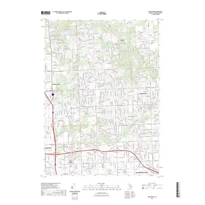
2023 Map of Rochester
USGS Topo · Published 2023About this map
The Clinton River and its various tributaries, including Paint Creek and Galloway Creek, form the central hydrological spine of this Oakland County landscape. This modern survey captures the complex suburban transition from the historic center of Rochester to the industrial and academic corridors of Auburn Hills and Pontiac. The map reflects a densely developed area balanced by significant green space, notably the Bald Mountain State Recreation Area in the northwest. Several institutions of higher learning, such as Oakland University and Rochester College, are prominently situated among the residential subdivisions and arterial roads like Woodward Ave. Local history is preserved in numerous burial grounds scattered across the terrain, from the large Mount Avon Cem near the heart of town to the more secluded Guardian Angel Cem and Bigler Cem, offering a detailed look at the region's contemporary geography.
Find a feature on this map
62 named features on this map. Tap any name to fly to it.
Don’t see what you’re looking for? This feature index may not catch every label — zoom into the map to look around manually.
Map Details
Editions of this 2023 Rochester Map
This is the sole edition of this map. No revisions or reprints were ever made.
Other maps of this area

1907 · Pontiac
USGS Topo · 1:62,500

1908 · Rochester
USGS Topo · 1:62,500

1936 · Warren
USGS Topo · 1:31,680

1936 · Birmingham
USGS Topo · 1:31,680

1936 · Rochester
USGS Topo · 1:31,680

1936 · Washington
USGS Topo · 1:31,680

1936 · Pontiac South
USGS Topo · 1:31,680

1936 · Pontiac North
USGS Topo · 1:31,680

1943 · Pontiac South
USGS Topo · 1:24,000

1943 · Pontiac North
USGS Topo · 1:24,000
Featured Places
- Rochester Hills, MI
- Pontiac, MI
- Orion Charter Township, MI
- Auburn Hills, MI
- Oakland Charter Township, MI