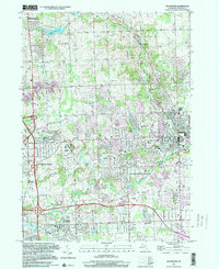
1997 Map of Rochester
USGS Topo · Published 2000About this map
Rochester Hills and Auburn Hills anchor this detailed study of northeastern Oakland County at the close of the 20th century. The landscape is characterized by the convergence of several waterways, including the winding Clinton River, Paint Creek, and Sargent Creek, which dictate the local topography and placement of early roads like Tienken Road. The map reveals a transition from the preserved natural space of the Bald Mountain State Recreation Area in the northwest to the dense institutional and suburban growth of Rochester, visible in the concentration of educational sites like Michigan Christian College and Oakland Community College. Local history is preserved in several burial grounds, including the centrally located Mt Avon Cemetery and the rural Paint Creek Cem, providing critical landmarks for genealogical research in this rapidly developing corridor.
Find a feature on this map
51 named features on this map. Tap any name to fly to it.
Don’t see what you’re looking for? This feature index may not catch every label — zoom into the map to look around manually.
Map Details
Editions of this 1997 Rochester Map
This is the sole edition of this map. No revisions or reprints were ever made.
Other maps of this area

1907 · Pontiac
USGS Topo · 1:62,500

1908 · Rochester
USGS Topo · 1:62,500

1936 · Warren
USGS Topo · 1:31,680

1936 · Birmingham
USGS Topo · 1:31,680

1936 · Rochester
USGS Topo · 1:31,680

1936 · Washington
USGS Topo · 1:31,680

1936 · Pontiac South
USGS Topo · 1:31,680

1936 · Pontiac North
USGS Topo · 1:31,680

1943 · Pontiac South
USGS Topo · 1:24,000

1943 · Pontiac North
USGS Topo · 1:24,000
Featured Places
- Rochester Hills, MI
- Pontiac, MI
- Orion Charter Township, MI
- Auburn Hills, MI
- Oakland Charter Township, MI