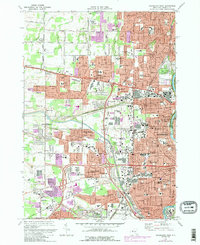
1971 Map of Rochester West
USGS Topo · Published 1988About this map
The Erie Canal cuts through this western portion of the city, marking a transition between the urban density of Rochester and the expanding suburbs of Greece and Chili. The landscape is defined by its institutional and transportation hubs, featuring the sprawling Rochester-Monroe Co Airport in the south and a concentration of ecclesiastical and educational landmarks like St Bernards Seminary and the Aquinas Institute. Large-scale cemeteries, including Holy Sepulchre Cemetery and Riverside Cemetery, occupy significant acreage near the Genesee River, providing vital research points for genealogists.
Find a feature on this map
91 named features on this map. Tap any name to fly to it.
Don’t see what you’re looking for? This feature index may not catch every label — zoom into the map to look around manually.
Map Details
Editions of this 1971 Rochester West Map
4 editions found
Other maps of this area

1895 · Rochester
USGS Topo · 1:62,500

1895 · Ontario Beach
USGS Topo · 1:62,500

1898 · Rochester
USGS Topo · 1:62,500

1899 · Hamlin
USGS Topo · 1:62,500

1899 · Ontario Beach
USGS Topo · 1:62,500

1899 · Brockport
USGS Topo · 1:62,500

1912 · Rochester
USGS Topo · 1:62,500

1912 · Ontario Beach
USGS Topo · 1:62,500

1920 · Rochester
USGS Topo · 1:62,500

1931 · Mendon Ponds
USGS Topo · 1:24,000