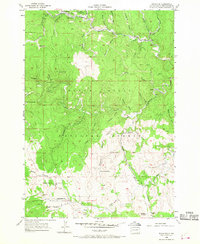
1956 Map of Rochford
USGS Topo · Published 1968About this map
Black Hills National Forest land defines this mid-century landscape, where a legacy of gold and minerals is visible through sites like the Standby Mine and Cuttys Ark Mine. The settlement of Rochford serves as a northern anchor near Moonshine Gulch, while the Burlington and Quincy and Chicago and North Western rail lines navigate the steep gulches of the Black Hills. To the south, Slate Prairie offers a more open upland terrain, distinct for its concentration of local community landmarks including the Slate Prairie School and Slate Prairie Church. The geography is deeply carved by drainage systems like Rapid Creek and Castle Creek, which supported early industrial sites such as the Lookout Mill. This survey provides a look at the transition from mining centers like Myersville and Mystic to the forestry and transport network of the 1950s.
Find a feature on this map
41 named features on this map. Tap any name to fly to it.
Don’t see what you’re looking for? This feature index may not catch every label — zoom into the map to look around manually.
Map Details
Editions of this 1956 Rochford Map
4 editions found
Other maps of this area

1894 · Deadwood
USGS Topo · 1:125,000

1896 · Harney Peak
USGS Topo · 1:125,000

1901 · Harney Peak
USGS Topo · 1:125,000

1901 · Deadwood
USGS Topo · 1:125,000

1916 · Deadwood
USGS Topo · 1:125,000

1953 · Nemo
USGS Topo · 1:24,000

1953 · Rapid City
USGS Topo · 1:250,000

1954 · Silver City
USGS Topo · 1:24,000

1954 · Hill City
USGS Topo · 1:24,000

1955 · Hot Springs
USGS Topo · 1:250,000