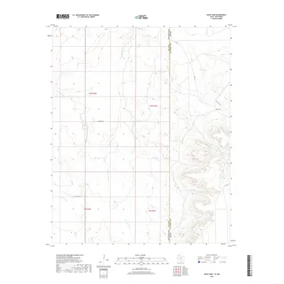
2019 Map of Rock Camp
USGS Topo · Published 2019About this map
Rock Camp sits along the high plains where the eastern edge of New Mexico meets the Texas Panhandle. This borderland landscape is defined by the ephemeral drainage systems of Sand Point Draw and the winding course of Arroyo del Puerto. The terrain exhibits a series of mesas and draws characteristic of the Llano Estacado, where water management is critical as evidenced by North Tank and Hill Tank. Remote ranching roads like Quay Road 56 and Co Rd 21 cross the state line between Quay and Deaf Smith counties, tracing the path of seasonal watercourses such as Martha Cr and Arroyo Trujillo. The map illustrates the sparse, high-altitude cattle country of the late twenty-first century, preserving the exact layout of modern section lines and ranch access points.
Find a feature on this map
19 named features on this map. Tap any name to fly to it.
Don’t see what you’re looking for? This feature index may not catch every label — zoom into the map to look around manually.
Map Details
Editions of this 2019 Rock Camp Map
This is the sole edition of this map. No revisions or reprints were ever made.
Other maps of this area

1954 · Tucumcari
USGS Topo · 1:250,000

1954 · Clovis
USGS Topo · 1:250,000

1958 · Clovis
USGS Topo · 1:250,000

1958 · Tucumcari
USGS Topo · 1:250,000

1966 · Moser Ranch
USGS Topo · 1:24,000

1966 · Sand Point
USGS Topo · 1:24,000

1968 · Rock Camp
USGS Topo · 1:24,000

1968 · Riley Camp
USGS Topo · 1:24,000

1968 · Bard
USGS Topo · 1:24,000

1968 · Glenrio
USGS Topo · 1:24,000