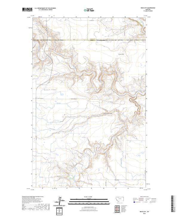
2024 Map of Rock City
USGS Topo · Published 2024About this map
The Two Medicine River and Birch Creek wind through this landscape at the Glacier and Pondera county line, carving deep paths through the high plains. The terrain is defined by dramatic elevation shifts, notably at Buffalo Ridge and Lookout Butte, which overlook a complex network of man-made waterways. This irrigation infrastructure is central to the area's geography, with the M Canal, N Canal, and Two M Canal tracing the contours of the land to manage water resources for the surrounding plateau. In the southern portion of the quadrangle, the presence of Blair Mine Rd and Rock City Rd suggests the historical importance of local extraction and access routes in this part of Montana. The map also captures the confluence near Cut Bank Creek, where the river systems meet in a maze of coulees like Rocky Ridge Coulee.
Find a feature on this map
24 named features on this map. Tap any name to fly to it.
Don’t see what you’re looking for? This feature index may not catch every label — zoom into the map to look around manually.
Map Details
Editions of this 2024 Rock City Map
This is the sole edition of this map. No revisions or reprints were ever made.
Other maps of this area

1907 · Blackfoot Res.
USGS Topo · 1:48,000

1909 · Cut Bank
USGS Topo · 1:125,000

1912 · Cut Bank
USGS Topo · 1:125,000

1920 · Dupuyer
USGS Topo · 1:125,000

1934 · Lake Frances
USGS Topo · 1:48,000

1934 · Valier
USGS Topo · 1:62,500

1937 · Valier
USGS Topo · 1:62,500

1937 · Lake Frances
USGS Topo · 1:62,500

1960 · Cut Bank
USGS Topo · 1:250,000

1963 · Cut Bank
USGS Topo · 1:250,000