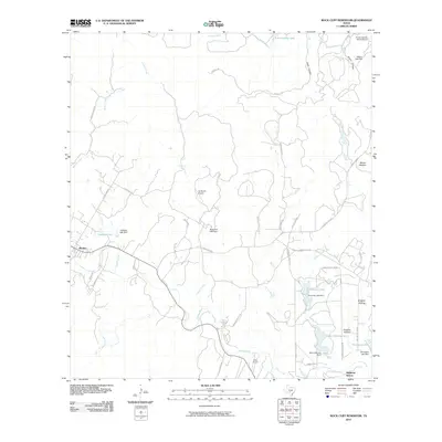
2010 Map of Rock Cliff Reservoir
USGS Topo · Published 2010About this map
The Medina River carves a deep path through the Bandera County landscape, anchoring a network of ranching properties and small water impoundments in the early 21st century. The town of Medina serves as the primary settlement hub, connected to the surrounding countryside by a dense system of ranch roads, including Ranch Rd 2828 and Ranch Rd 3240. The topography is defined by significant relief, notably at Mount Medina and through steep drainages like Crow Canyon and Prison Canyon.
Find a feature on this map
44 named features on this map. Tap any name to fly to it.
Don’t see what you’re looking for? This feature index may not catch every label — zoom into the map to look around manually.
Map Details
Editions of this 2010 Rock Cliff Reservoir Map
This is the sole edition of this map. No revisions or reprints were ever made.
Other maps of this area

1954 · San Antonio
USGS Topo · 1:250,000

1956 · Tarpley
USGS Topo · 1:62,500

1956 · Tuff
USGS Topo · 1:62,500

1956 · Bandera
USGS Topo · 1:62,500

1956 · Center Point
USGS Topo · 1:62,500

1957 · San Antonio
USGS Topo · 1:250,000

1964 · Center Point
USGS Topo · 1:24,000

1964 · Echo Hill Ranch
USGS Topo · 1:24,000

1964 · Bandera
USGS Topo · 1:24,000

1964 · Rock Cliff Reservoir
USGS Topo · 1:24,000