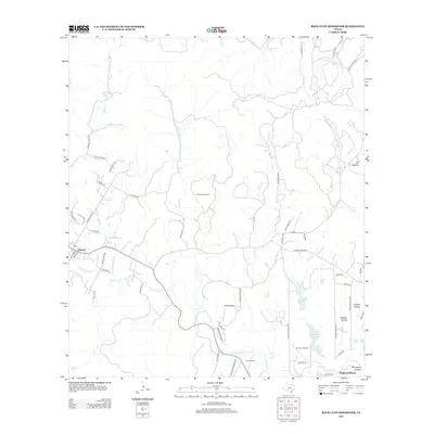
2013 Map of Rock Cliff Reservoir
USGS Topo · Published 2013About this map
Medina serves as the primary hub in this Texas Hill Country landscape, where the Medina River carves a winding path through the limestone terrain. The 2013 survey illustrates a transition from rural ranchlands to more dense residential pockets near the water, particularly at Highland Waters and the neighborhoods surrounding the Rock Cliff Reservoir. Local aviation is well-represented by the T-4 Ranch Airport and Flying L Airport, reflecting the sprawling nature of private landholdings in Bandera County.
Find a feature on this map
64 named features on this map. Tap any name to fly to it.
Don’t see what you’re looking for? This feature index may not catch every label — zoom into the map to look around manually.
Map Details
Editions of this 2013 Rock Cliff Reservoir Map
This is the sole edition of this map. No revisions or reprints were ever made.
Other maps of this area

1954 · San Antonio
USGS Topo · 1:250,000

1956 · Tarpley
USGS Topo · 1:62,500

1956 · Tuff
USGS Topo · 1:62,500

1956 · Bandera
USGS Topo · 1:62,500

1956 · Center Point
USGS Topo · 1:62,500

1957 · San Antonio
USGS Topo · 1:250,000

1964 · Center Point
USGS Topo · 1:24,000

1964 · Echo Hill Ranch
USGS Topo · 1:24,000

1964 · Bandera
USGS Topo · 1:24,000

1964 · Rock Cliff Reservoir
USGS Topo · 1:24,000