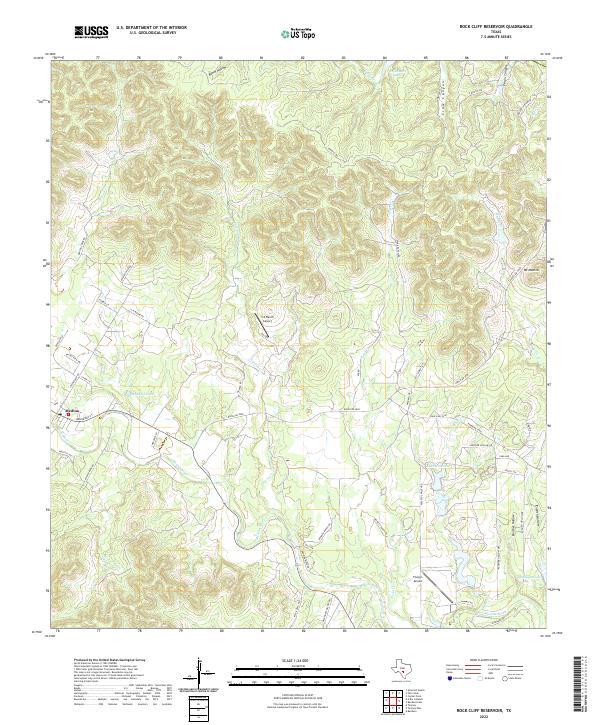
2022 Map of Rock Cliff Reservoir
USGS Topo · Published 2022About this map
The Medina River carves a deep path through the Texas Hill Country in this modern survey, providing a vital water source for the settlement of Medina. The landscape is defined by its dramatic relief, with numerous steep-walled drainages such as Panther Hollow, English Hollow, and Crow Canyon feeding into the river system. These landforms create a naturally segmented geography where ranching and local aviation have historically flourished, evidenced by the presence of the T-4 Ranch Airport and Flying L Airport.
Find a feature on this map
60 named features on this map. Tap any name to fly to it.
Don’t see what you’re looking for? This feature index may not catch every label — zoom into the map to look around manually.
Map Details
Editions of this 2022 Rock Cliff Reservoir Map
This is the sole edition of this map. No revisions or reprints were ever made.
Other maps of this area

1954 · San Antonio
USGS Topo · 1:250,000

1956 · Tarpley
USGS Topo · 1:62,500

1956 · Tuff
USGS Topo · 1:62,500

1956 · Bandera
USGS Topo · 1:62,500

1956 · Center Point
USGS Topo · 1:62,500

1957 · San Antonio
USGS Topo · 1:250,000

1964 · Center Point
USGS Topo · 1:24,000

1964 · Echo Hill Ranch
USGS Topo · 1:24,000

1964 · Bandera
USGS Topo · 1:24,000

1964 · Rock Cliff Reservoir
USGS Topo · 1:24,000