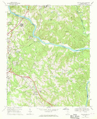
1968 Map of Rock Hill East
USGS Topo · Published 1970About this map
The Catawba River winds through the heart of this landscape, separating the developing outskirts of Rock Hill from the rural expanse of York and Lancaster counties. In the late 1960s, the area reflects a transition from agrarian life to industrial and educational growth, evidenced by the Filtration Plant and the York County Tech Ed Center. Small communities like Red River and Lesslie are anchored by long-standing social institutions, including Mt Hebron Ch and the Hillcrest Sch.
Find a feature on this map
47 named features on this map. Tap any name to fly to it.
Don’t see what you’re looking for? This feature index may not catch every label — zoom into the map to look around manually.
Map Details
Editions of this 1968 Rock Hill East Map
4 editions found
Other maps of this area

1905 · Charlotte
USGS Topo · 1:48,000

1907 · Charlotte
USGS Topo · 1:62,500

1941 · Charlotte
USGS Topo · 1:125,000

1941 · Spartanburg
USGS Topo · 1:250,000

1942 · Charlotte
USGS Topo · 1:125,000

1947 · Clover
USGS Topo · 1:62,500

1949 · Clover
USGS Topo · 1:62,500

1949 · Rock Hill
USGS Topo · 1:62,500

1953 · Spartanburg
USGS Topo · 1:250,000

1953 · Charlotte
USGS Topo · 1:250,000