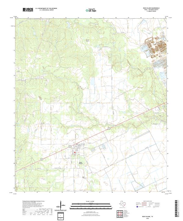
2022 Map of Rock Island
USGS Topo · Published 2022About this map
Rock Island serves as the central hub of this South Texas landscape, where the town grid is defined by streets like Lupton St, Cushen St, and 2nd St. The settlement is situated along the Alt 90 corridor, south of the open expanse of Buzzard Prairie. The surrounding terrain is a network of slow-moving coastal plain waterways, with Crasco Cr and Little Crasco Cr draining the northern reaches, while Pinoak Cr and Bucksnag Cr wind through the south. This 2022 survey captures the modern rural layout of Colorado County, where established landmarks like Myrtle Cem and water features like Black Lake and Prairie Lake provide historical continuity. The map highlights a transition from traditional agricultural lands toward residential developments on the eastern edge near Deer Run Rd.
Find a feature on this map
60 named features on this map. Tap any name to fly to it.
Don’t see what you’re looking for? This feature index may not catch every label — zoom into the map to look around manually.
Map Details
Editions of this 2022 Rock Island Map
This is the sole edition of this map. No revisions or reprints were ever made.
Other maps of this area

1953 · Seguin
USGS Topo · 1:250,000

1956 · Glidden
USGS Topo · 1:62,500

1957 · Eagle Lake
USGS Topo · 1:62,500

1957 · Altair
USGS Topo · 1:24,000

1957 · Columbus
USGS Topo · 1:24,000

1957 · Borden
USGS Topo · 1:24,000

1958 · Seguin
USGS Topo · 1:250,000

1958 · Alleyton
USGS Topo · 1:24,000

1959 · Garwood
USGS Topo · 1:24,000

1965 · Sawmill Branch
USGS Topo · 1:24,000