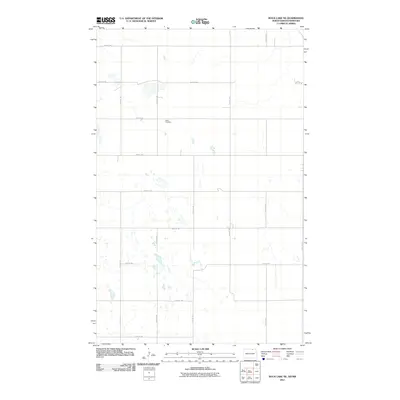
2011 Map of Rock Lake NE
USGS Topo · Published 2011About this map
Dash Cemetery sits centrally within this landscape of the North Dakota prairie near the Canadian border, south of the Sarles vicinity. The terrain is characterized by a dense network of small seasonal water bodies and wetlands, particularly concentrated south of 105th St Ne and west of 75th Ave Ne. A rigid grid of section-line roads, including 108th St Ne and 77th Ave Ne, defines the agricultural layout of the region. This survey captures the sparse, rural nature of Cavalier County, where the occasional farmstead or burial ground like Dash Cemetery provides a historical anchor amidst the shifting hydrology and vast cultivated fields typical of the Red River Valley hinterlands.
Find a feature on this map
16 named features on this map. Tap any name to fly to it.
Don’t see what you’re looking for? This feature index may not catch every label — zoom into the map to look around manually.
Map Details
Editions of this 2011 Rock Lake NE Map
This is the sole edition of this map. No revisions or reprints were ever made.
Other maps of this area

1953 · Devils Lake
USGS Topo · 1:250,000

1956 · Devils Lake
USGS Topo · 1:250,000

1969 · Rock Lake NE
USGS Topo · 1:24,000
1969 · Rock Lake NW
USGS Topo · 1:24,000

1970 · Calvin
USGS Topo · 1:24,000

1970 · Sarles
USGS Topo · 1:24,000

1970 · Rock Lake
USGS Topo · 1:24,000

1970 · Rock Lake SE
USGS Topo · 1:24,000

1985 · Langdon
USGS Topo · 1:100,000

1985 · Rock Lake
USGS Topo · 1:100,000