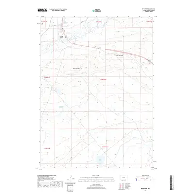
2017 Map of Rock River
USGS Topo · Published 2017About this map
Rock River sits as the primary settlement in this portion of Albany County, established along the banks where Rock Creek meanders through the high plains. The landscape is defined by the sharp elevations of Upper Pine Ridge and Lower Pine Ridge, which dictate the local drainage patterns toward water bodies like Rainey Lake and the Coal Bank Reservoir. Significant for genealogists, the Rock River Cem is located just north of the town center, near the junction of Old State Hwy 13 and Thornton Ln. The map documents a classic Wyoming ranching and transit corridor, where small local routes like White St and N 4th St serve the concentrated townsite, while drainages such as Coalbank Cr and Dutton Cr cut across the surrounding township and range grids.
Find a feature on this map
21 named features on this map. Tap any name to fly to it.
Don’t see what you’re looking for? This feature index may not catch every label — zoom into the map to look around manually.
Map Details
Editions of this 2017 Rock River Map
This is the sole edition of this map. No revisions or reprints were ever made.
Other maps of this area

1915 · Como Ridge
USGS Topo · 1:48,000

1918 · Como Ridge
USGS Topo · 1:62,500

1954 · Cheyenne
USGS Topo · 1:250,000

1954 · Rawlins
USGS Topo · 1:250,000

1955 · Big Judson
USGS Topo · 1:24,000

1955 · Cooper Lake South
USGS Topo · 1:24,000

1955 · Cooper Lake North
USGS Topo · 1:24,000

1955 · Rock River
USGS Topo · 1:24,000

1955 · Cannonball Cut
USGS Topo · 1:24,000

1955 · Wilcox
USGS Topo · 1:24,000