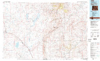
1982 Map of Rock River
USGS Topo · Published 1982About this map
Rock River and the high plains of the Laramie Basin define this 1982 landscape, where the Union Pacific railroad corridor serves as the primary artery for local commerce. The map records a series of small trackside settlements including Lookout, Harper, and Bosler, as well as the more remote Farthing (Iron Mtn PO) near the Albany and Laramie county border. The water management infrastructure is a dominant feature, anchored by the expansive Wheatland Reservoir No 2 and Wheatland Reservoir No 3, which contrast with natural water bodies like Cooper Lake. To the east, the Laramie Mountains rise sharply, punctuated by landmarks such as Squaw Mountain and Moonshine Peak. This survey provides a look at the region's diverse land use, from the Sybille Game and Fish Experimental Unit to the legacy of transportation evidenced by the Old Railroad Grade.
Find a feature on this map
43 named features on this map. Tap any name to fly to it.
Don’t see what you’re looking for? This feature index may not catch every label — zoom into the map to look around manually.
Map Details
Editions of this 1982 Rock River Map
This is the sole edition of this map. No revisions or reprints were ever made.
Other maps of this area

1895 · Laramie
USGS Topo · 1:125,000

1896 · Hartville
USGS Topo · 1:125,000

1901 · Hartville
USGS Topo · 1:125,000

1902 · Laramie
USGS Topo · 1:125,000

1905 · Sherman
USGS Topo · 1:125,000

1905 · Laramie
USGS Topo · 1:125,000

1906 · Medicine Bow
USGS Topo · 1:125,000

1906 · Laramie
USGS Topo · 1:125,000

1908 · Laramie
USGS Topo · 1:125,000

1908 · Medicine Bow
USGS Topo · 1:125,000