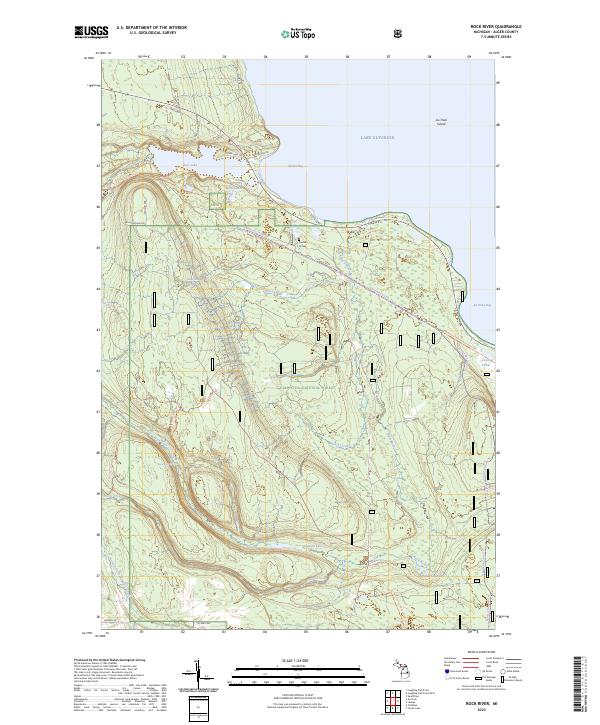
2023 Map of Rock River
USGS Topo · Published 2023About this map
Hemlock Bluff and the shores of Lake Superior define this section of the Upper Peninsula, where the landscape is largely protected by the Hiawatha National Forest. This modern survey reveals a dense network of water and wilderness, including the Rock River Canyon Wilderness and the tucked-away Rock River Falls. For those tracing local heritage, Trudell's Graves remains a distinct point of interest near Shelter Bay. The map documents the modern intersection of recreational access and conservation, featuring the North Country National Scenic Trl alongside snowmobile paths like the N Hiawatha Snomo Trl. From the offshore Au Train Island to the interior drainage of Silver Creek and Ginpole Lake, the area maintains its character as a remote wilderness corridor in Alger County.
Find a feature on this map
41 named features on this map. Tap any name to fly to it.
Don’t see what you’re looking for? This feature index may not catch every label — zoom into the map to look around manually.
Map Details
Editions of this 2023 Rock River Map
This is the sole edition of this map. No revisions or reprints were ever made.
Other maps of this area

1932 · Skandia SE
USGS Topo · 1:31,680

1932 · Skandia NE
USGS Topo · 1:31,680

1958 · Au Train
USGS Topo · 1:62,500

1958 · Laughing Fish Point
USGS Topo · 1:62,500

1958 · Skandia
USGS Topo · 1:62,500

1958 · Marquette
USGS Topo · 1:250,000

1960 · Marquette
USGS Topo · 1:250,000

1961 · Marquette
USGS Topo · 1:250,000

1968 · Marquette
USGS Topo · 1:250,000
1983 · Gwinn
USGS Topo · 1:100,000
Featured Places
- Rock River, Onota Township
- Rock River Township, MI
- Onota Township, MI
- Onata, Onota Township
- Alger County, MI