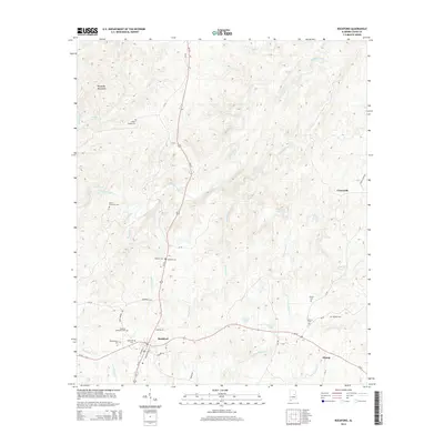
2014 Map of Rockford
USGS Topo · Published 2014About this map
Rockford serves as the focal point of this Coosa County landscape, situated at the intersection of Us-231 and Al-22. The terrain is defined by the southern reaches of the Weogufka Mountains and a dense network of waterways, most notably the winding course of Hatchet Creek. Genealogists will find a high concentration of burial sites throughout the area, from the Old Rockford Cem and Rockford Methodist Cem near the town center to more outlying locations like the Miller Patterson Cem and Poplar Springs Cem. The map reveals a rural settlement pattern with small communities such as Hissop and Crewsville connected by a web of county roads. Natural water features like McEwen Spring and Howards Pond are scattered across the varied topography, providing insight into the local hydrology that has historically influenced the placement of farms and homesites in this part of Alabama.
Find a feature on this map
48 named features on this map. Tap any name to fly to it.
Don’t see what you’re looking for? This feature index may not catch every label — zoom into the map to look around manually.
Map Details
Editions of this 2014 Rockford Map
This is the sole edition of this map. No revisions or reprints were ever made.
Other maps of this area

1890 · Talladega
USGS Topo · 1:125,000

1892 · Talladega
USGS Topo · 1:125,000

1901 · Wetumpka
USGS Topo · 1:125,000

1903 · Wetumpka
USGS Topo · 1:125,000

1915 · Gantts Quarry
USGS Topo · 1:48,000

1917 · Gantts Quarry
USGS Topo · 1:62,500

1944 · Goodwater
USGS Topo · 1:62,500

1947 · Goodwater
USGS Topo · 1:62,500

1953 · Montgomery
USGS Topo · 1:250,000

1953 · Birmingham
USGS Topo · 1:250,000