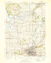
1938 Map of Rockford
USGS Topo · Published 1955About this map
Rockford dominates the southern landscape of this 1938 revision, situated at the confluence of the Rock River and Keith Creek. The city's industrial and residential footprint is shown alongside Loves Park and Westmoreland, while the surrounding Winnebago County countryside is defined by an intensive network of rural one-room schoolhouses. Notable institutions such as the Winnebago County Boys Reform School and numerous named schools like Whig Hill School and Falconer School suggest a densely populated farming community.
Find a feature on this map
78 named features on this map. Tap any name to fly to it.
Don’t see what you’re looking for? This feature index may not catch every label — zoom into the map to look around manually.
Map Details
Editions of this 1938 Rockford Map
3 editions found

Other maps of this area

1891 · Janesville
USGS Topo · 1:62,500

1893 · Janesville
USGS Topo · 1:62,500

1893 · Brodhead
USGS Topo · 1:62,500

1893 · Shopiere
USGS Topo · 1:62,500

1917 · Kings
USGS Topo · 1:62,500

1918 · Rockford
USGS Topo · 1:62,500

1918 · Belvidere
USGS Topo · 1:62,500

1918 · Kings
USGS Topo · 1:62,500

1918 · Kirkland
USGS Topo · 1:62,500

1922 · Oregon
USGS Topo · 1:62,500