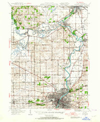
1938 Map of Rockford
USGS Topo · Published 1964About this map
The Rock River corridor anchors this northern Illinois landscape, serving as the industrial and transport spine for growing communities like South Beloit, Rockton, and Rockford. This 1938 revision captures the region before mid-century suburbanization, showing a dense network of rural schoolhouses such as Mud School, Sweet School, and Canada School that served the outlying townships. The map documents significant local institutions like the Winnebago County Boys Reform School and the Rockford Cem, providing specific touchpoints for local historians.
Find a feature on this map
72 named features on this map. Tap any name to fly to it.
Don’t see what you’re looking for? This feature index may not catch every label — zoom into the map to look around manually.
Map Details
Editions of this 1938 Rockford Map
3 editions found

Other maps of this area

1891 · Janesville
USGS Topo · 1:62,500

1893 · Janesville
USGS Topo · 1:62,500

1893 · Brodhead
USGS Topo · 1:62,500

1893 · Shopiere
USGS Topo · 1:62,500

1917 · Kings
USGS Topo · 1:62,500

1918 · Rockford
USGS Topo · 1:62,500

1918 · Belvidere
USGS Topo · 1:62,500

1918 · Kings
USGS Topo · 1:62,500

1918 · Kirkland
USGS Topo · 1:62,500

1922 · Oregon
USGS Topo · 1:62,500