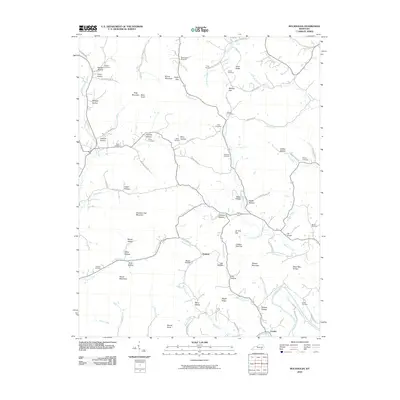
2010 Map of Rockholds
USGS Topo · Published 2010About this map
Louden sits at the southern edge of this quadrangle, where the Cumberland River curves through a landscape defined by narrow hollows and high ridges. The settlement of Perkins is located further north along Browns Creek, serving as a central point for a series of family-named landmarks including Jones Hollow and Berry Hollow. The terrain is characterized by named elevations such as Chestnut Oak Mountain, Bunch Mountain, and Lawson High Top, which rise above the many drainages that feed into Meadow Creek and Watts Creek. For genealogists, the map is particularly rich in family history data, showing numerous small burial grounds including McNeil Cemetery, Stanfield Cemetery, McFarland Cemetery, and Bays Cemetery. These cemeteries, often positioned near specific gaps like Cedar Gap or Tar Kiln Gap, provide a detailed record of the community's distribution across the Whitley County hillsides.
Find a feature on this map
91 named features on this map. Tap any name to fly to it.
Don’t see what you’re looking for? This feature index may not catch every label — zoom into the map to look around manually.
Map Details
Editions of this 2010 Rockholds Map
This is the sole edition of this map. No revisions or reprints were ever made.
Other maps of this area

1886 · Cumberland Gap
USGS Topo · 1:125,000

1888 · Cumberland Gap
USGS Topo · 1:125,000

1890 · Williamsburg
USGS Topo · 1:125,000

1891 · Cumberland Gap
USGS Topo · 1:125,000

1894 · Williamsburg
USGS Topo · 1:125,000

1952 · Corbin
USGS Topo · 1:24,000

1952 · Wofford
USGS Topo · 1:24,000

1952 · Barbourville
USGS Topo · 1:24,000

1952 · Heidrick
USGS Topo · 1:24,000

1952 · Vox
USGS Topo · 1:24,000