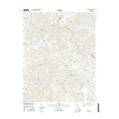
2016 Map of Rockholds
USGS Topo · Published 2016About this map
The Cumberland River winds through the southeastern corner of this terrain, marking the lower boundary of a landscape defined by deep hollows and prominent ridges. Small communities like Rockholds, Perkins, and Louden anchor the valleys, connected by a network of rural routes such as Old Corbin Rd and Maple Creek Rd. The map is particularly rich for family history research, documenting numerous small burial grounds including McNeil Cem, Davis Cem, and Hart Cem. These sites, often positioned on hillsides or near named gaps like Whitley Gap, suggest a long history of generational settlement. High points such as King Mtn and Lawson High Top provide a clear view of the complex drainage system of creeks like Watts Cr and Meadow Cr that have carved out the area's distinctive topography.
Find a feature on this map
95 named features on this map. Tap any name to fly to it.
Don’t see what you’re looking for? This feature index may not catch every label — zoom into the map to look around manually.
Map Details
Editions of this 2016 Rockholds Map
This is the sole edition of this map. No revisions or reprints were ever made.
Other maps of this area

1886 · Cumberland Gap
USGS Topo · 1:125,000

1888 · Cumberland Gap
USGS Topo · 1:125,000

1890 · Williamsburg
USGS Topo · 1:125,000

1891 · Cumberland Gap
USGS Topo · 1:125,000

1894 · Williamsburg
USGS Topo · 1:125,000

1952 · Corbin
USGS Topo · 1:24,000

1952 · Wofford
USGS Topo · 1:24,000

1952 · Barbourville
USGS Topo · 1:24,000

1952 · Heidrick
USGS Topo · 1:24,000

1952 · Vox
USGS Topo · 1:24,000