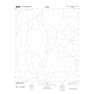
2012 Map of Rocking Chair Ranch
USGS Topo · Published 2012About this map
Rocking Chair Ranch and Crowbar Ranch anchor this West Texas landscape in Tom Green County, representing the area's enduring ranching tradition into the early 21st century. The terrain is defined by the drainage patterns of Kickapoo Cr in the north and Rocky Cr to the south, which carve through the high plateau. Transportation in this sparsely populated region is limited to essential corridors like Bill Pfluger Rd and Susan Peak Rd, illustrating the vast distances and isolated nature of modern livestock operations. This 2012 survey provides a precise view of rural infrastructure, from remote ranch structures to the secondary road networks that connect these large landholdings to the wider county.
Find a feature on this map
8 named features on this map. Tap any name to fly to it.
Don’t see what you’re looking for? This feature index may not catch every label — zoom into the map to look around manually.
Map Details
Editions of this 2012 Rocking Chair Ranch Map
This is the sole edition of this map. No revisions or reprints were ever made.
Other maps of this area

1892 · San Angelo
USGS Topo · 1:125,000

1893 · Fort McKavett
USGS Topo · 1:125,000

1954 · Sonora
USGS Topo · 1:250,000

1954 · San Angelo
USGS Topo · 1:250,000

1958 · Sonora
USGS Topo · 1:250,000

1958 · San Angelo
USGS Topo · 1:250,000

1963 · Adams
USGS Topo · 1:24,000

1965 · San Angelo
USGS Topo · 1:250,000

1970 · Rocking Chair Ranch
USGS Topo · 1:24,000
1970 · Burr Oak Creek
USGS Topo · 1:24,000