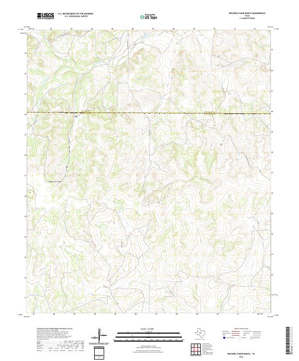
2022 Map of Rocking Chair Ranch
USGS Topo · Published 2022About this map
The northern border of Schleicher County meets Tom Green County in this West Texas ranchland landscape. The terrain is defined by the drainage basins of Kickapoo Cr and Rocky Cr, which carve through the high limestone plateaus typical of the Edwards Plateau region. Settlement remains sparse, represented largely by private ranch infrastructure and a network of arterial roads. The presence of Bill Pfluger Road Private and Rocking Chair Ln reflects the enduring private landownership patterns of this cattle and sheep-raising district. Local transportation is anchored by Farm Rd 1223, which provides the primary north-south connection across these rolling divides. This modern survey illustrates the persistent rural character of the Concho Valley hinterlands, where the landscape remains focused on water sources and extensive grazing tracts.
Find a feature on this map
7 named features on this map. Tap any name to fly to it.
Don’t see what you’re looking for? This feature index may not catch every label — zoom into the map to look around manually.
Map Details
Editions of this 2022 Rocking Chair Ranch Map
This is the sole edition of this map. No revisions or reprints were ever made.
Other maps of this area

1892 · San Angelo
USGS Topo · 1:125,000

1893 · Fort McKavett
USGS Topo · 1:125,000

1954 · Sonora
USGS Topo · 1:250,000

1954 · San Angelo
USGS Topo · 1:250,000

1958 · Sonora
USGS Topo · 1:250,000

1958 · San Angelo
USGS Topo · 1:250,000

1963 · Adams
USGS Topo · 1:24,000

1965 · San Angelo
USGS Topo · 1:250,000

1970 · Rocking Chair Ranch
USGS Topo · 1:24,000
1970 · Burr Oak Creek
USGS Topo · 1:24,000