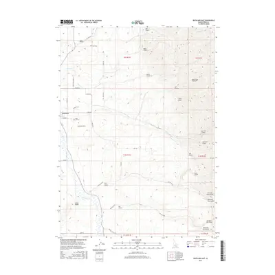
2017 Map of Rockland East
USGS Topo · Published 2017About this map
Rockland sits at the western edge of this Power County landscape, overlooking the broad expanse of Rockland Valley. The terrain is defined by the high elevations of the Deep Creek Mountains to the east, which are deeply incised by numerous drainages including East Fork Canyon and Hutchinson Canyon. Water management is central to the area's geography, visible through features like the Bench Ditch and the branching systems of E Fork Rock Cr and Spring Cr.
Find a feature on this map
51 named features on this map. Tap any name to fly to it.
Don’t see what you’re looking for? This feature index may not catch every label — zoom into the map to look around manually.
Map Details
Editions of this 2017 Rockland East Map
This is the sole edition of this map. No revisions or reprints were ever made.
Other maps of this area

1934 · Rockland
USGS Topo · 1:62,500

1937 · Rockland
USGS Topo · 1:62,500

1938 · Pauline
USGS Topo · 1:48,000

1944 · Arbon
USGS Topo · 1:62,500

1954 · Pocatello
USGS Topo · 1:250,000

1958 · Pocatello
USGS Topo · 1:250,000

1971 · Rockland East
USGS Topo · 1:24,000

1971 · Bannock Peak
USGS Topo · 1:24,000
1971 · Sawmill Creek
USGS Topo · 1:24,000
1971 · Indian Springs
USGS Topo · 1:24,000