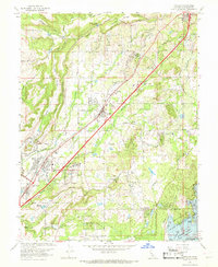
1967 Map of Rocklin
USGS Topo · Published 1968About this map
Southern Pacific rail lines anchor this landscape, connecting a series of foothills communities from Roseville through Rocklin, Loomis, Penryn, and Newcastle. The terrain is defined by a series of southwest-flowing drainage systems, including Secret Ravine and Miners Ravine, which drop toward the newly formed Folsom Lake at the bottom of the sheet. Educational and religious institutions are prominent landmarks, such as Sierra College and the Mount St Joseph Seminary, alongside local schools like Del Oro High Sch and Placer Sch.
Find a feature on this map
46 named features on this map. Tap any name to fly to it.
Don’t see what you’re looking for? This feature index may not catch every label — zoom into the map to look around manually.
Map Details
Editions of this 1967 Rocklin Map
3 editions found
Other maps of this area

1891 · Sacramento
USGS Topo · 1:125,000

1892 · Sacramento
USGS Topo · 1:125,000

1893 · Sacramento
USGS Topo · 1:125,000

1902 · Fairoaks
USGS Topo · 1:62,500

1910 · Lincoln
USGS Topo · 1:31,680

1910 · Roseville
USGS Topo · 1:31,680

1911 · Antelope
USGS Topo · 1:31,680

1914 · Folsom
USGS Topo · 1:31,680

1941 · Folsom
USGS Topo · 1:62,500
1942 · Markham Ravine
USGS Topo · 1:62,500