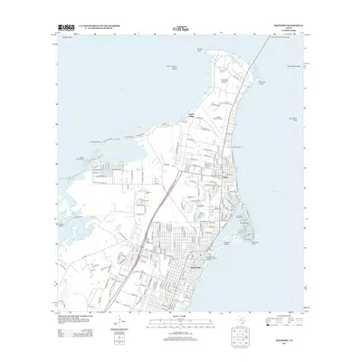
2013 Map of Rockport
USGS Topo · Published 2013About this map
The coastal community of Rockport and the neighboring town of Fulton define this section of the Live Oak Peninsula, situated between the waters of Copano Bay and Aransas Bay. The landscape is characterized by a mix of established residential grids and water-dependent infrastructure, including the Aransas County Navigation District Marina and the specialized finger-canals of Key Allegro. Beyond the residential centers, the economy is linked to the Aransas County Airport and energy production at the Fulton Beach Gas and Oil Field. Local history is preserved at the Rockport Cem and McLester Cem, while the Lyndon B Johnson Causeway provides a primary transit link across the bay. The map reveals a high density of named streets and coastal features like Little Bay, reflecting the area's development as a significant Texas Gulf Coast hub for maritime activity and recreation.
Find a feature on this map
186 named features on this map. Tap any name to fly to it.
Don’t see what you’re looking for? This feature index may not catch every label — zoom into the map to look around manually.
Map Details
Editions of this 2013 Rockport Map
This is the sole edition of this map. No revisions or reprints were ever made.
Other maps of this area

1925 · Aransas Pass
USGS Topo · 1:62,500

1950 · Corpus Christi
USGS Topo · 1:250,000

1951 · Allyns Bight
USGS Topo · 1:24,000

1952 · St. Charles Bay SW
USGS Topo · 1:24,000

1952 · St. Charles Bay
USGS Topo · 1:24,000

1953 · Beeville
USGS Topo · 1:250,000

1954 · Rockport
USGS Topo · 1:62,500

1954 · Aransas Pass
USGS Topo · 1:24,000

1954 · Estes
USGS Topo · 1:24,000

1954 · Aransas Pass
USGS Topo · 1:62,500