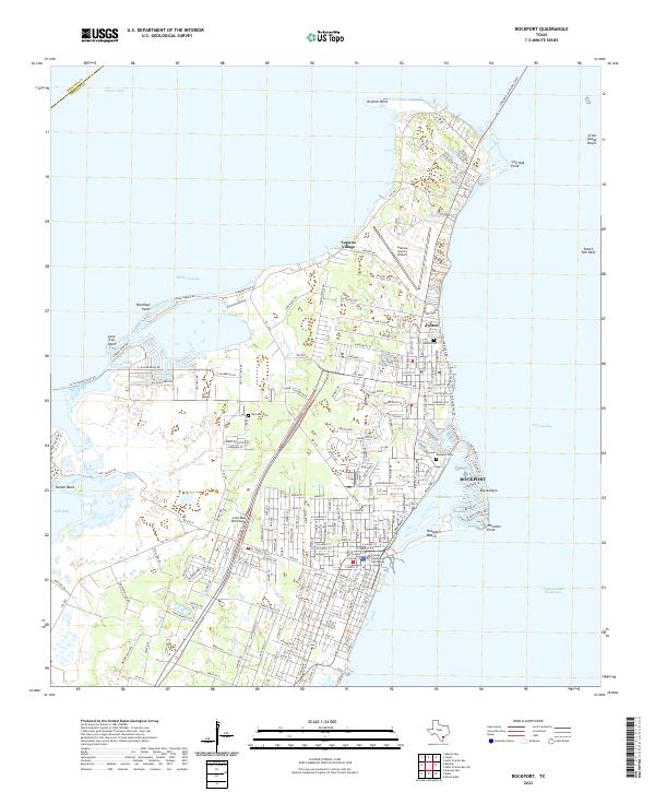
2022 Map of Rockport
USGS Topo · Published 2022About this map
Live Oak Peninsula defines the coastal landscape of this modern survey, where the waters of Aransas Bay meet the sprawling residential and maritime infrastructure of Rockport. The map details the dense street grids of the county seat, centered around the Aransas County Courthouse and extending toward the protected waters of Little Bay. Development patterns show a clear emphasis on waterfront access, notably at Key Allegro and the recreational expanse of Rockport Beach. To the north, Copano Village and the Aransas County Airport occupy the land near Redfish Point. Genealogists will find the locations of Fulton Cem, Rockport Cem, and McLester Cem particularly useful for locating family sites within the shifting suburban landscape. The Intracoastal Waterway remains a critical navigation feature, while the Lyndon B Johnson Cswy provides the primary link across the bays to the mainland.
Find a feature on this map
199 named features on this map. Tap any name to fly to it.
Don’t see what you’re looking for? This feature index may not catch every label — zoom into the map to look around manually.
Map Details
Editions of this 2022 Rockport Map
This is the sole edition of this map. No revisions or reprints were ever made.
Other maps of this area

1925 · Aransas Pass
USGS Topo · 1:62,500

1950 · Corpus Christi
USGS Topo · 1:250,000

1951 · Allyns Bight
USGS Topo · 1:24,000

1952 · St. Charles Bay SW
USGS Topo · 1:24,000

1952 · St. Charles Bay
USGS Topo · 1:24,000

1953 · Beeville
USGS Topo · 1:250,000

1954 · Rockport
USGS Topo · 1:62,500

1954 · Aransas Pass
USGS Topo · 1:24,000

1954 · Estes
USGS Topo · 1:24,000

1954 · Aransas Pass
USGS Topo · 1:62,500