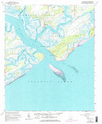
1960 Map of Rockville
USGS Topo · Published 1972About this map
The coastal village of Rockville sits at the confluence of several major waterways in this 1960s era topographic study. Located on Wadmalaw Island, the settlement serves as a gateway to the complex network of salt marshes and tidal creeks, including Bohicket Creek and the North Edisto River. The map details a landscape shaped by shifting sands and maritime history, featuring the expansive Seabrook Beach and the dynamic Deveaux Bank offshore.
Find a feature on this map
41 named features on this map. Tap any name to fly to it.
Don’t see what you’re looking for? This feature index may not catch every label — zoom into the map to look around manually.
Map Details
Editions of this 1960 Rockville Map
4 editions found
Other maps of this area

1918 · Kiawah Island
USGS Topo · 1:21,120

1919 · Edisto Island
USGS Topo · 1:62,500

1919 · Wadmelaw Island
USGS Topo · 1:62,500

1919 · Legareville
USGS Topo · 1:21,120

1920 · St. Helena Sound
USGS Topo · 1:62,500

1943 · Legareville
USGS Topo · 1:24,000

1943 · Edisto Island
USGS Topo · 1:62,500

1943 · Kiawah Island
USGS Topo · 1:24,000

1944 · Wadmelaw Island
USGS Topo · 1:62,500

1947 · Savannah
USGS Topo · 1:250,000