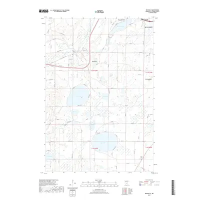
2019 Map of Rockville
USGS Topo · Published 2019About this map
Rockville sits at the heart of this landscape, positioned where the Sauk River flows near Rockville Lake. The area is defined by a dense network of glacial lakes, including the large expanses of Grand Lake and Pearl Lake, which are interspersed with smaller bodies like Mud Lake and Marty Lake. This geography has historically dictated the winding path of local roads such as Lake Rd and Ahles Rd, which navigate around the wetlands and water. To the northeast, the map transitions into the suburban edges of Waite Park and St. Cloud, while St. Augusta anchors the eastern border. Genealogists may find value in the locations of Calvary Cem and the Maine Prairie Cem, which offer physical links to the early farming communities that settled these townships.
Find a feature on this map
89 named features on this map. Tap any name to fly to it.
Don’t see what you’re looking for? This feature index may not catch every label — zoom into the map to look around manually.
Map Details
Editions of this 2019 Rockville Map
This is the sole edition of this map. No revisions or reprints were ever made.
Other maps of this area

1950 · St. Cloud
USGS Topo · 1:62,500

1951 · Annandale
USGS Topo · 1:62,500

1953 · Saint Cloud
USGS Topo · 1:250,000

1957 · Saint Cloud
USGS Topo · 1:250,000

1958 · Saint Cloud
USGS Topo · 1:250,000

1965 · St Joseph
USGS Topo · 1:24,000

1965 · Avon
USGS Topo · 1:24,000

1967 · Cold Spring
USGS Topo · 1:24,000

1967 · Watkins
USGS Topo · 1:24,000

1967 · Rockville
USGS Topo · 1:24,000