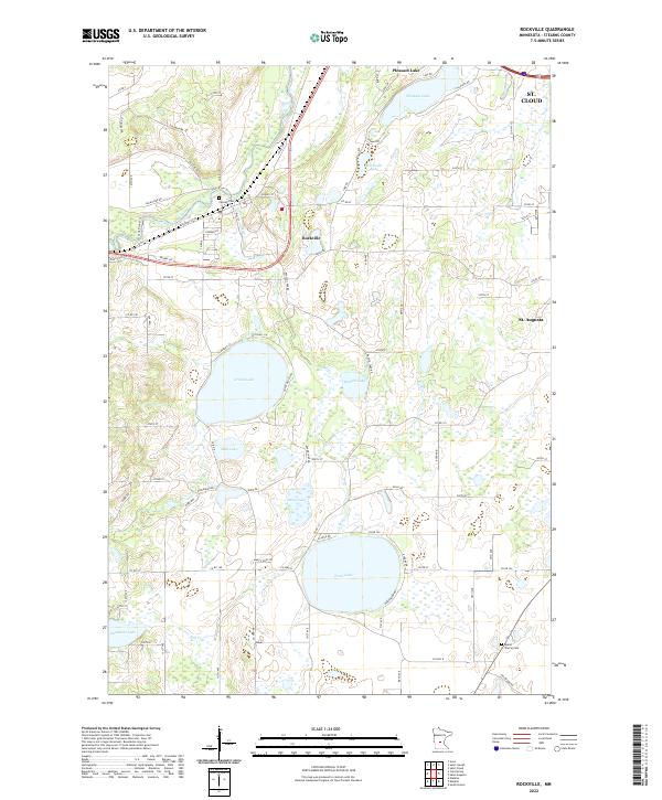
2022 Map of Rockville
USGS Topo · Published 2022About this map
Rockville sits at a geographic pivot point where the Sauk River meets Mill Cr, surrounded by a landscape defined by its glacial kettle lakes and wetland basins. This area of Stearns County maintains a distinct rural character, with the Sauk River Trl tracing the water's edge and providing a window into the natural corridors of the region. The map captures the transition from the river valley to the elevated plains where Pearl Lake and Grand Lake dominate the southern and central terrain, serving as primary hydrologic landmarks for the township.
Find a feature on this map
92 named features on this map. Tap any name to fly to it.
Don’t see what you’re looking for? This feature index may not catch every label — zoom into the map to look around manually.
Map Details
Editions of this 2022 Rockville Map
This is the sole edition of this map. No revisions or reprints were ever made.
Other maps of this area

1950 · St. Cloud
USGS Topo · 1:62,500

1951 · Annandale
USGS Topo · 1:62,500

1953 · Saint Cloud
USGS Topo · 1:250,000

1957 · Saint Cloud
USGS Topo · 1:250,000

1958 · Saint Cloud
USGS Topo · 1:250,000

1965 · St Joseph
USGS Topo · 1:24,000

1965 · Avon
USGS Topo · 1:24,000

1967 · Cold Spring
USGS Topo · 1:24,000

1967 · Watkins
USGS Topo · 1:24,000

1967 · Rockville
USGS Topo · 1:24,000