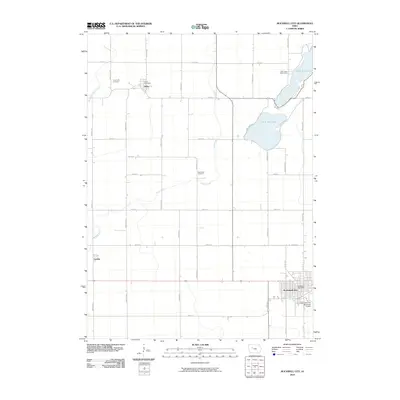
2010 Map of Rockwell City
USGS Topo · Published 2010About this map
Rockwell City serves as a primary hub for this central Iowa landscape, characterized by its grid of rural roads and agricultural plots in the early 21st century. The map highlights the distinct pairing of North Twin Lake and South Twin Lake, which provide a natural focal point for the region, complete with the nearby Twin Lakes Bible Camp. To the west, the smaller settlements of Jolley and Lavinia maintain their presence along the section lines, with the Jolley Post Office and Crown Hill Cemetery marking the enduring footprint of these local communities.
Find a feature on this map
36 named features on this map. Tap any name to fly to it.
Don’t see what you’re looking for? This feature index may not catch every label — zoom into the map to look around manually.
Map Details
Editions of this 2010 Rockwell City Map
This is the sole edition of this map. No revisions or reprints were ever made.
Other maps of this area

1954 · Fort Dodge
USGS Topo · 1:250,000

1957 · Fort Dodge
USGS Topo · 1:250,000

1958 · Fort Dodge
USGS Topo · 1:250,000

1979 · Fonda
USGS Topo · 1:24,000

1979 · Manson
USGS Topo · 1:24,000

1979 · Pomeroy
USGS Topo · 1:24,000

1980 · Lytton
USGS Topo · 1:24,000

1980 · Rockwell City
USGS Topo · 1:24,000

1980 · Yetter
USGS Topo · 1:24,000
1980 · Richard
USGS Topo · 1:24,000