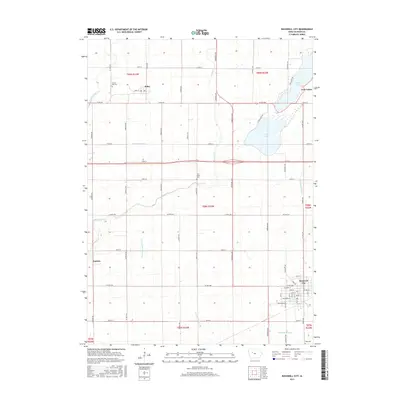
2015 Map of Rockwell City
USGS Topo · Published 2015About this map
Rockwell City serves as the focal point of this Calhoun County landscape, where the town's grid meets the expansive agricultural reaches of the Iowa plains. The transition from town to country is marked by a sophisticated water management system, including Joint Drainage Ditch 16 and Drainage Ditch 198, which transformed these prairies into productive farmland. To the north, the twin basins of N Twin Lake and S Twin Lake provide a natural contrast to the geometric section lines, supporting the community of Twin Lakes. Small, dispersed settlements like Jolley and the rail-oriented Lavinia dot the township borders, while sacred sites such as Crown Hill Cem and Twin Lakes Cem offer important genealogical touchpoints. The map captures the enduring legacy of the Public Land Survey System, with roads like Inwood Ave and Langley Ave strictly following section boundaries.
Find a feature on this map
66 named features on this map. Tap any name to fly to it.
Don’t see what you’re looking for? This feature index may not catch every label — zoom into the map to look around manually.
Map Details
Editions of this 2015 Rockwell City Map
This is the sole edition of this map. No revisions or reprints were ever made.
Other maps of this area

1954 · Fort Dodge
USGS Topo · 1:250,000

1957 · Fort Dodge
USGS Topo · 1:250,000

1958 · Fort Dodge
USGS Topo · 1:250,000

1979 · Fonda
USGS Topo · 1:24,000

1979 · Manson
USGS Topo · 1:24,000

1979 · Pomeroy
USGS Topo · 1:24,000

1980 · Lytton
USGS Topo · 1:24,000

1980 · Rockwell City
USGS Topo · 1:24,000

1980 · Yetter
USGS Topo · 1:24,000
1980 · Richard
USGS Topo · 1:24,000