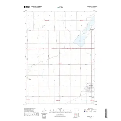
2018 Map of Rockwell City
USGS Topo · Published 2018About this map
Rockwell City serves as the focal point of this Calhoun County landscape, where the town's residential grid transitions into the expansive agricultural sections characteristic of northwestern Iowa. The region is defined by an intricate network of man-made waterways, including Drainage Ditch 6, Drainage Ditch 65, and Joint Drainage Ditch 16, which support the intensive farming economy by managing the flat terrain's water flow toward natural features like Camp Cr. This systematic drainage reflects a century-long effort to transform prairie wetlands into productive cropland.
Find a feature on this map
45 named features on this map. Tap any name to fly to it.
Don’t see what you’re looking for? This feature index may not catch every label — zoom into the map to look around manually.
Map Details
Editions of this 2018 Rockwell City Map
This is the sole edition of this map. No revisions or reprints were ever made.
Other maps of this area

1954 · Fort Dodge
USGS Topo · 1:250,000

1957 · Fort Dodge
USGS Topo · 1:250,000

1958 · Fort Dodge
USGS Topo · 1:250,000

1979 · Fonda
USGS Topo · 1:24,000

1979 · Manson
USGS Topo · 1:24,000

1979 · Pomeroy
USGS Topo · 1:24,000

1980 · Lytton
USGS Topo · 1:24,000

1980 · Rockwell City
USGS Topo · 1:24,000

1980 · Yetter
USGS Topo · 1:24,000
1980 · Richard
USGS Topo · 1:24,000