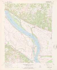
1968 Map of Rockwood
USGS Topo · Published 1969About this map
The Mississippi River defines the border between Illinois and Missouri in this late 1960s study, shaping a landscape of shifting river islands and fertile bottomlands. Crains Island and Rockwood Island sit within the wide channel, while the Illinois side is dominated by the steep, wooded bluffs of the Shawnee National Forest. The settlement of Rockwood is positioned at the base of these bluffs, serving as a focal point for the surrounding rural townships.
Find a feature on this map
39 named features on this map. Tap any name to fly to it.
Don’t see what you’re looking for? This feature index may not catch every label — zoom into the map to look around manually.
Map Details
Editions of this 1968 Rockwood Map
3 editions found
Other maps of this area

1915 · Chester
USGS Topo · 1:62,500

1916 · Campbell Hill
USGS Topo · 1:62,500

1918 · Altenburg
USGS Topo · 1:62,500

1918 · Campbell Hill
USGS Topo · 1:62,500

1923 · Perryville
USGS Topo · 1:62,500

1924 · Perryville
USGS Topo · 1:62,500

1925 · Altenburg
USGS Topo · 1:62,500

1947 · Chester
USGS Topo · 1:62,500

1947 · Crosstown
USGS Topo · 1:24,000

1947 · Altenburg
USGS Topo · 1:62,500