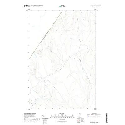
2021 Map of Rocky Brook
USGS Topo · Published 2021About this map
The international border between the Canada and the United States slices through the northwest corner of this Maine landscape, marking a remote boundary in the North Woods of Aroostook County. The terrain is defined by a dense network of timber-access routes and watercourses, including the Little Black River and its various tributaries like the W Br Little Black River and Campbell Br Little Black River. Roads such as Irving Rd, Escourt Rd, and Rocky Brook Rd lattice the topography, reflecting the area's role in the regional logging industry. Notable water features include Rideout Pond and Beaver Br, while land use is further indicated by local waypoints like Gravel Pit Rd and Boat Landing Rd, which suggest the practical, resource-based navigation of this northern frontier.
Find a feature on this map
15 named features on this map. Tap any name to fly to it.
Don’t see what you’re looking for? This feature index may not catch every label — zoom into the map to look around manually.
Map Details
Editions of this 2021 Rocky Brook Map
This is the sole edition of this map. No revisions or reprints were ever made.
Other maps of this area

1930 · Allagash
USGS Topo · 1:48,000

1933 · Allagash
USGS Topo · 1:62,500

1955 · Rocky Mountain
USGS Topo · 1:62,500

1955 · Rocky Brook
USGS Topo · 1:62,500

1955 · Beau Lake
USGS Topo · 1:62,500

1962 · Edmundston
USGS Topo · 1:250,000
1987 · Johnson Brook Mountain
USGS Topo · 1:24,000

1987 · Hafey Pond
USGS Topo · 1:24,000
1987 · Saint-Eleuthere
USGS Topo · 1:24,000
1987 · Morrison Brook
USGS Topo · 1:24,000