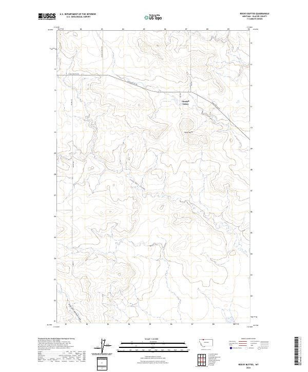
2024 Map of Rocky Buttes
USGS Topo · Published 2024About this map
Glendale Colony serves as a focal point in this portion of Glacier County, situated among the undulating terrain marked by the Rocky Buttes. The landscape is defined by its drainage patterns, notably Little Rock Coulee and the South Fork Little Rock Coulee, which carve through the plains. The road network is sparse, consisting primarily of gravel or dirt routes such as Chalk Butte Rd, Landslide Butte Rd, and Brown Rd, reflecting a rural agricultural and ranching character. This survey illustrates the modern persistence of communal agricultural settlements in northern Montana, providing a clear record of the area's contemporary land use and topographic contours.
Find a feature on this map
11 named features on this map. Tap any name to fly to it.
Don’t see what you’re looking for? This feature index may not catch every label — zoom into the map to look around manually.
Map Details
Editions of this 2024 Rocky Buttes Map
This is the sole edition of this map. No revisions or reprints were ever made.
Other maps of this area

1907 · Blackfoot Res.
USGS Topo · 1:48,000

1909 · Cut Bank
USGS Topo · 1:125,000

1911 · Blackfoot
USGS Topo · 1:125,000

1912 · Cut Bank
USGS Topo · 1:125,000

1960 · Cut Bank
USGS Topo · 1:250,000

1963 · Cut Bank
USGS Topo · 1:250,000

1964 · Cut Bank
USGS Topo · 1:250,000
1966 · Gunsight
USGS Topo · 1:24,000

1968 · Buffalo Lake
USGS Topo · 1:24,000
1968 · Dead Indian Spring
USGS Topo · 1:24,000