
1968 Map of Rocky Buttes
USGS Topo · Published 1972About this map
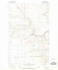
The Blackfeet Indian Reservation landscape is defined here by the winding course of Little Rock Coulee as it carves through the high plains of Glacier County. Mapping conducted in the late 1960s highlights the topographical prominence of the Rocky Buttes, a series of elevations that dominate the central portion of the quadrangle. The terrain is characterized by a sparse distribution of water sources, with a lone Spring located near the base of the buttes providing a rare point of relief in this arid environment. Human impact on the land is represented by long-distance infrastructure, specifically a Pipeline that traverses the southern section of the map, and a network of selected fence lines. The survey captures a moment when the region remained largely open rangeland, marked primarily by natural drainage patterns and the transition between townships T. 36 N. and T. 35 N.
Find a feature on this map
5 named features on this map. Tap any name to fly to it.
Don’t see what you’re looking for? This feature index may not catch every label — zoom into the map to look around manually.
Map Details
Editions of this 1968 Rocky Buttes Map
This is the sole edition of this map. No revisions or reprints were ever made.
Other maps of this area

1907 · Blackfoot Res.
USGS Topo · 1:48,000

1909 · Cut Bank
USGS Topo · 1:125,000

1911 · Blackfoot
USGS Topo · 1:125,000

1912 · Cut Bank
USGS Topo · 1:125,000

1960 · Cut Bank
USGS Topo · 1:250,000

1963 · Cut Bank
USGS Topo · 1:250,000

1964 · Cut Bank
USGS Topo · 1:250,000
1966 · Gunsight
USGS Topo · 1:24,000

1968 · Buffalo Lake
USGS Topo · 1:24,000
1968 · Dead Indian Spring
USGS Topo · 1:24,000