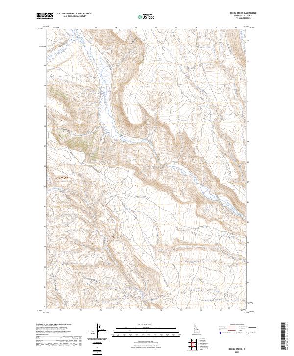
2023 Map of Rocky Creek
USGS Topo · Published 2023About this map
Medicine Lodge Creek dominates this high-country drainage system in Clark County, where the landscape is defined by the convergence of several major tributaries. The water network includes Edie Creek, Webber Creek, and the South Fork Deep Creek, illustrating a complex watershed that has historically dictated travel and land use in this part of Idaho. Settlement patterns here are sparse, represented primarily by the primitive road network such as Medicine Lodge Rd and Deep Creek Rd that follow these natural corridors.
Find a feature on this map
19 named features on this map. Tap any name to fly to it.
Don’t see what you’re looking for? This feature index may not catch every label — zoom into the map to look around manually.
Map Details
Editions of this 2023 Rocky Creek Map
This is the sole edition of this map. No revisions or reprints were ever made.
Other maps of this area

1955 · Dubois
USGS Topo · 1:250,000

1957 · Paul Reservoir
USGS Topo · 1:62,500

1957 · Edie Ranch
USGS Topo · 1:62,500

1958 · Dubois
USGS Topo · 1:250,000

1964 · Small
USGS Topo · 1:24,000

1969 · Shamrock Gulch
USGS Topo · 1:24,000

1969 · Lidy Hot Springs
USGS Topo · 1:24,000

1983 · Dubois
USGS Topo · 1:100,000
1987 · Indian Creek
USGS Topo · 1:24,000
1987 · Fritz Peak
USGS Topo · 1:24,000