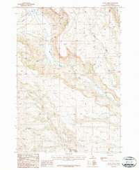
1987 Map of Rocky Creek
USGS Topo · Published 1987About this map
Medicine Lodge Creek dominates this high-altitude Clark County landscape, where deep drainage systems like the South Fork Deep Creek and Rocky Creek carve through the high mountain plateaus. This 1980s USGS study, based on 1981 aerial photography, reveals a wilderness terrain primarily defined by its hydrography and elevation rather than human settlement. The presence of a prominent Trans Line and several 4wd tracks suggests this area served as a corridor for utility infrastructure and resource management. Small-scale features like the high-country Lake and the protected basin of the Hollow provide specific landmarks for those studying the remote geography of the Idaho-Montana border region during this era of modern topographic mapping.
Find a feature on this map
12 named features on this map. Tap any name to fly to it.
Don’t see what you’re looking for? This feature index may not catch every label — zoom into the map to look around manually.
Map Details
Editions of this 1987 Rocky Creek Map
This is the sole edition of this map. No revisions or reprints were ever made.
Other maps of this area

1955 · Dubois
USGS Topo · 1:250,000

1957 · Paul Reservoir
USGS Topo · 1:62,500

1957 · Edie Ranch
USGS Topo · 1:62,500

1958 · Dubois
USGS Topo · 1:250,000

1964 · Small
USGS Topo · 1:24,000

1969 · Shamrock Gulch
USGS Topo · 1:24,000

1969 · Lidy Hot Springs
USGS Topo · 1:24,000

1983 · Dubois
USGS Topo · 1:100,000
1987 · Indian Creek
USGS Topo · 1:24,000
1987 · Fritz Peak
USGS Topo · 1:24,000