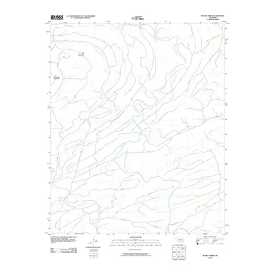
2010 Map of Rocky Creek
USGS Topo · Published 2010About this map
The Glover River and its major tributaries define this landscape in McCurtain County, Oklahoma. The confluence of the West Fork Glover River and East Fork Glover River occurs here, creating a complex drainage network that includes Beeman Creek, Pine Creek, and Rocky Creek. The terrain is characterized by significant elevations such as Big Horseshoe Mountain and Little Horseshoe Mountain, which rise above the surrounding valleys.
Find a feature on this map
23 named features on this map. Tap any name to fly to it.
Don’t see what you’re looking for? This feature index may not catch every label — zoom into the map to look around manually.
Map Details
Editions of this 2010 Rocky Creek Map
This is the sole edition of this map. No revisions or reprints were ever made.
Other maps of this area

1901 · Alikchi
USGS Topo · 1:125,000

1902 · Lukfata
USGS Topo · 1:125,000

1950 · Mcalester
USGS Topo · 1:250,000

1959 · Golden
USGS Topo · 1:62,500

1960 · Bethel
USGS Topo · 1:62,500

1962 · McAlester
USGS Topo · 1:250,000

1962 · Alikchi
USGS Topo · 1:24,000

1962 · Signal Mountain
USGS Topo · 1:24,000

1965 · McAlester
USGS Topo · 1:250,000
1972 · Clebit
USGS Topo · 1:24,000