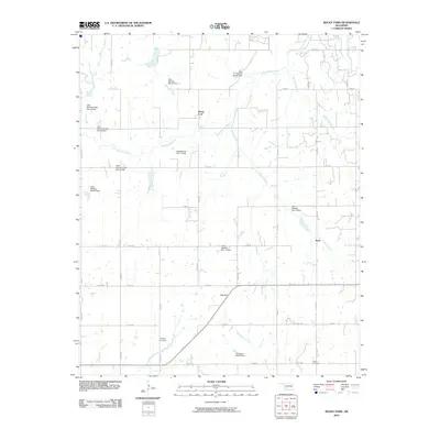
2010 Map of Rocky Ford
USGS Topo · Published 2010About this map
Rocky Ford and the small settlement of Acme anchor this landscape in Grady County, defined by the winding course of the Little Washita River and its numerous tributaries. The area is marked by a sophisticated water management network, featuring a series of numbered flood control structures such as Little Washita Site 34 Dam and Little Washita Site 15 Dam. These dams dot the drainage basins of McCarty Creek, Charlie Creek, and Little Rush Creek, reflecting the region's mid-century efforts to stabilize the watershed and protect agricultural interests.
Find a feature on this map
43 named features on this map. Tap any name to fly to it.
Don’t see what you’re looking for? This feature index may not catch every label — zoom into the map to look around manually.
Map Details
Editions of this 2010 Rocky Ford Map
This is the sole edition of this map. No revisions or reprints were ever made.
Other maps of this area

1902 · Rush Springs
USGS Topo · 1:125,000

1949 · Cement
USGS Topo · 1:62,500

1949 · Nellie
USGS Topo · 1:62,500

1949 · Rush Springs
USGS Topo · 1:62,500

1950 · Rush Springs
USGS Topo · 1:62,500

1950 · Marlow
USGS Topo · 1:62,500

1951 · Marlow
USGS Topo · 1:62,500

1955 · Lawton
USGS Topo · 1:250,000

1956 · Sterling
USGS Topo · 1:24,000

1956 · Laverty
USGS Topo · 1:24,000