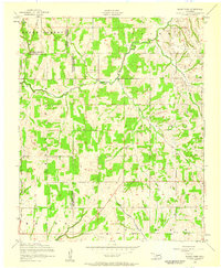
1956 Map of Rocky Ford
USGS Topo · Published 1959About this map
Washita River and Little Washita River dominate the landscape of this mid-century survey where the borders of Caddo, Grady, and Comanche Counties converge. The settlement of Rocky Ford sits near the river bend, surrounded by a terrain organized into distinct sections like South Cement, Grove, and Cedar. This 1950s documentation shows a rural economy defined by scattered homesteads and the emerging extraction industry, evidenced by a lone oil well in the eastern hills. Local community life is anchored by the Cedar Grove Church and the Ridley Cemetery, located along a network of unimproved and light-duty roads. Numerous drainage features such as Cottonwood Creek, Charlie Creek, and McCarthy Creek illustrate the complex hydrology of this part of Oklahoma, providing a detailed look at the land before later development.
Find a feature on this map
23 named features on this map. Tap any name to fly to it.
Don’t see what you’re looking for? This feature index may not catch every label — zoom into the map to look around manually.
Map Details
Editions of this 1956 Rocky Ford Map
2 editions found
Other maps of this area

1902 · Rush Springs
USGS Topo · 1:125,000

1949 · Cement
USGS Topo · 1:62,500

1949 · Nellie
USGS Topo · 1:62,500

1949 · Rush Springs
USGS Topo · 1:62,500

1950 · Rush Springs
USGS Topo · 1:62,500

1950 · Marlow
USGS Topo · 1:62,500

1951 · Marlow
USGS Topo · 1:62,500

1955 · Lawton
USGS Topo · 1:250,000

1956 · Sterling
USGS Topo · 1:24,000

1956 · Laverty
USGS Topo · 1:24,000